City of Saline Maps
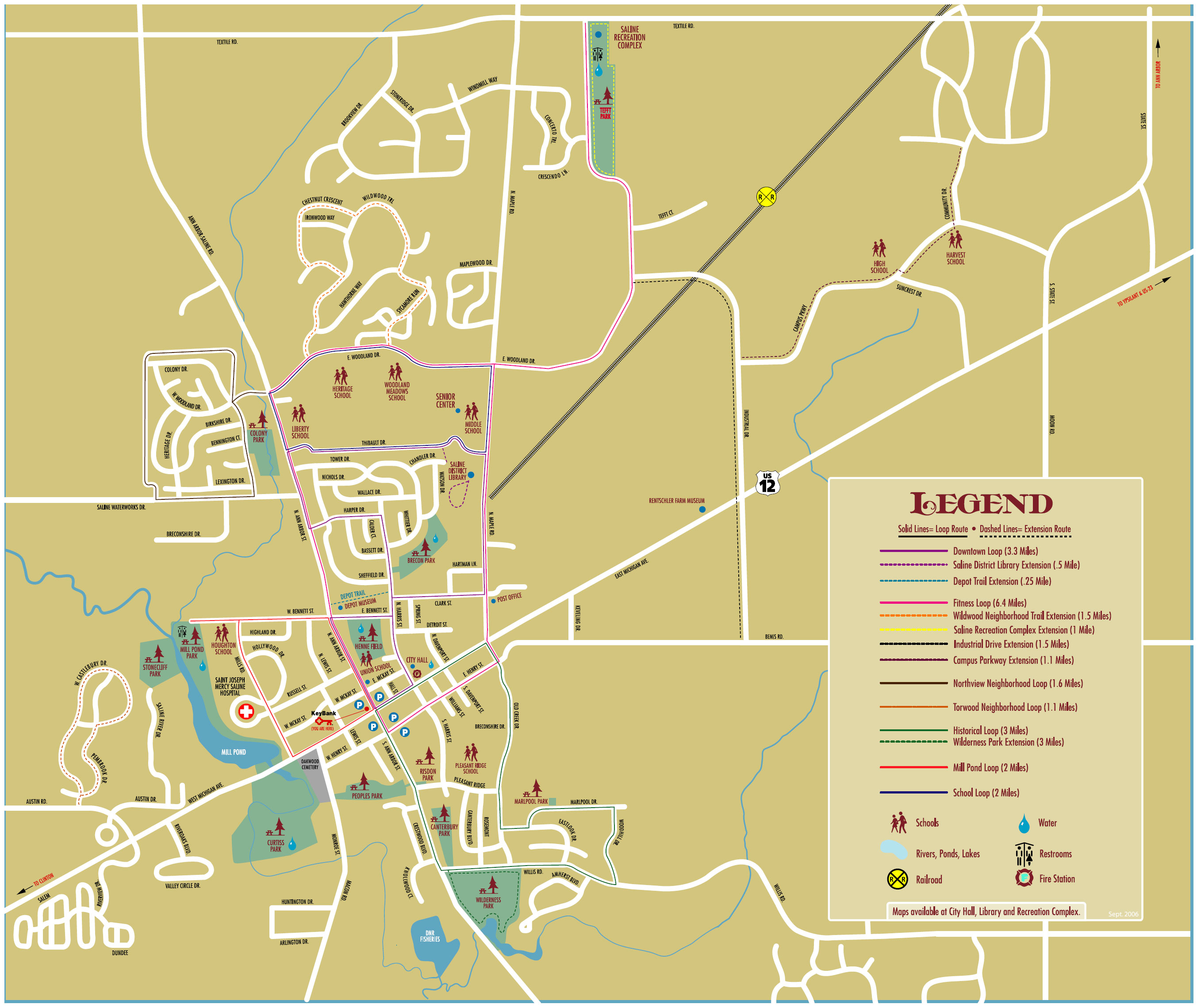
Saline Walking Map
There are many walking routes and paths in Saline - this map was developed by PUPS in the fall of 2006, and a large scale version was mounted outside KeyBank, on the corner of Michigan Ave. and Ann Arbor St.
Click the map for a larger version you can print.
Downtown Parking Map
Click the Map below to get a downloadable map. Downtown Saline has free four-hour parking in three centrally located lots, from 8am–6pm, Monday-Saturday. There is also two hour on-street parking on the 100 blocks of N. & S. Ann Arbor Streets. The McKay Street lot and the lot on the south side of Henry are open for all-day parking. All day on-street spaces are available on E. & W. McKay between Harris and Lewis, and on E. & W. Henry between Harris and Lewis.

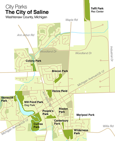
Parks of Saline
The Parks and Recreation Department maintains more than 11 developed parks and open spaces totaling more than 190 acres. This includes neighborhood and community parks with playgrounds, play equipment, picnic areas, sports fields, basketball courts, boat launch ramps, restrooms, and other special facilities.