South Ann Arbor Street Local Historic District
The South Ann Arbor Street Local Historic District, designated in 2007, is located one block south of the main “four corners” of downtown Saline.
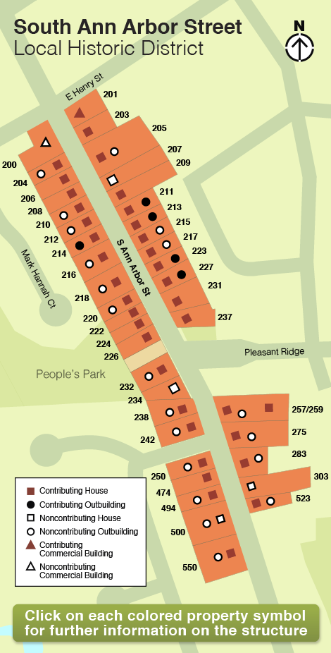
The northern boundary of the district begins at the intersection of Henry Street and continues approximately two blocks to the south. The boundaries of the district are shown on the attached map and include both the east and west sides of South Ann Arbor Street, from 200 to 550 South Ann Arbor Street. The southern boundary on the west side of the street is 550 and 523 on the east side.
The streetscape of the South Ann Arbor Street Local Historic District is represented by a variety of architectural styles dating from the mid-1800s to the mid-1900s. The styles include (but are not limited to) Gothic Revival, Dutch Colonial Revival, Italianate, American Four Square, vernacular Victorian styles, Craftsman, and mid-century modern subtypes. Many of the residences within this district are associated with significant persons in Saline’s history, including Samuel Van Duzer (205 South Ann Arbor) who held a number of village posts and helped to establish the village by-laws in 1866. Agricultural businessman John Henry Barr and sons George and William (211, 275, and 550 South Ann Arbor Street) owned an apple orchard and operated sorghum, apple jelly and cider mills.
Using the map
Click on a symbol or parcel to see more detail about the property and a photo of the structure.
For further information on Local Historic Districts in Michigan, please click on the following link.